§ THE TESSELLATION TOOL IN THE SPATIAL XL RIBBON ALLOWS YOU TO BUILD A TESSELLATION - A REPEATING
PATTERN OF POLYGONS THAT COVERS AN AREA WITH NO GAPS OR OVERLAPS.
1.Click the TOOLS tab in the Spatial XL ribbon.
2. Click the TESSELLATION button.
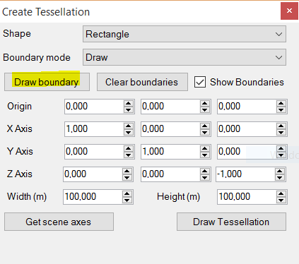
3. In the CREATE TESSELLATION box you can choose whether your output will be rectangles (squares) or hexagons.
4. In this example choose RECTANGLE from the SHAPE drop down menu.
5. You can choose to draw a tessellation boundary or select one from an existing layer.
6. In this example choose DRAW from BOUNDARY MODE.
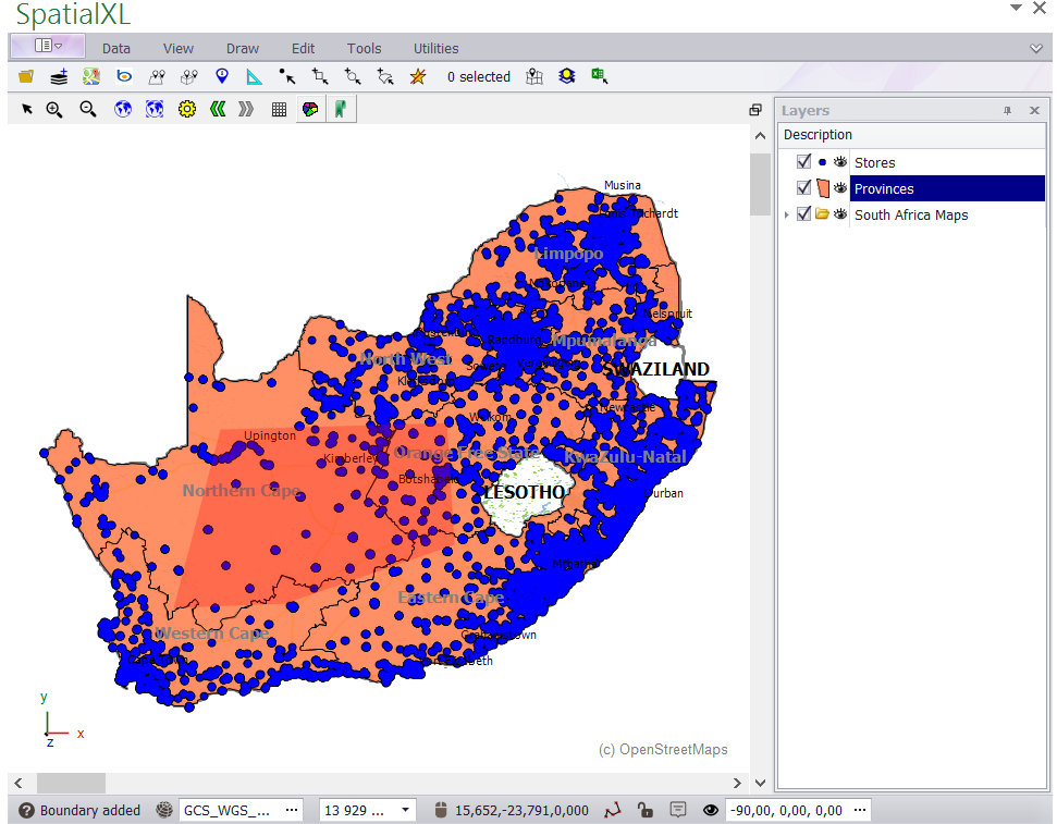
7. Click DRAW BOUNDARY and move your cursor to your map to draw the boundary.
8. Draw the boundary of the tessellation you require on the map - left click on the map to draw the boundary points. Double click to finish.
9. You can right click at any time while drawing the boundary to remove a point.
10. If you want to completely change the boundary you have drawn, click CLEAR BOUNDARIES in the CREATE
TESSELLATION box. Then click DRAW BOUNDARY again and redraw the boundary.
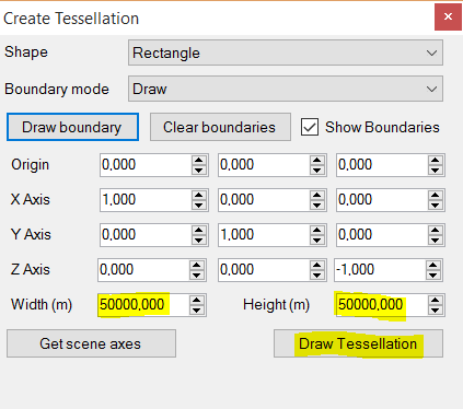
11. When you have finished drawing the boundary, choose the required WIDTH (50 000) and HEIGHT (50 000) for the
rectangles (squares) in the CREATE TESSELLATION box - This is in meters.
12. Then click DRAW TESSELLATION.
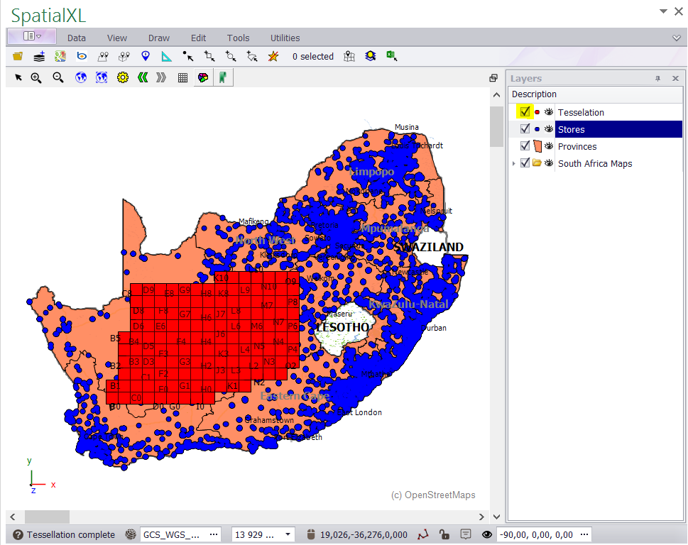
13. The tessellation will add to your map as a new layer.
14. Each polygon (square) will have automatically been assigned a unique reference number e.g. A0 etc.
|
Copyright (c) PrimeThought Software Solutions CC


