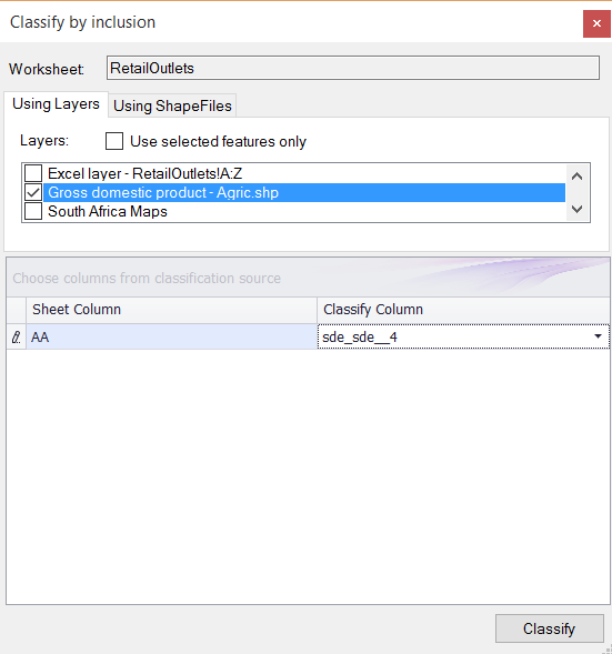
§ THE CLASSIFY TOOL IN THE SPATIAL RIBBON ALLOWS YOU TO DO A SPATIAL JOIN AND ASSIGN COLUMN(S) FROM
A SHAPEFILE LAYER E.G. PROVINCES TO A SPREADSHEET WITH GEOGRAPHIC COORDINATES E.G. STORES.
1.Make sure both your layers are mapped and ticked on in the LAYERS DESCRIPTION box.
2. Browse to the last column of your data sheet e.g. STORES and enter headings for the data you want to make use of e.g.
sde_sde__4 (WHICH IS ACTUALLY PROVINCES).
3. Select and highlight the column(s) - this column(s) will be populated when you run the classification.
4. Click CLASSIFY in the Spatial XL ribbon to open the CLASSIFY BY INCLUSION box.
5. Make sure the USING LAYERS tab is selected.
6. From the LAYERS drop down list select the area layer e.g. PROVINCES.
7. From the CLASSIFY COLUMN list select the fields you want to make use of e.g. sde_sde__4
8. Click CLASSIFY to finish.
9. The classify columns will populate with the column values e.g. AREA.
10. Each customer has been linked to the corresponding shapefile e.g. PROVINCES. |
Copyright (c) PrimeThought Software Solutions CC


