Using the measure tool ![]() you can measure distances (length in meters) between multiple points on your map
you can measure distances (length in meters) between multiple points on your map
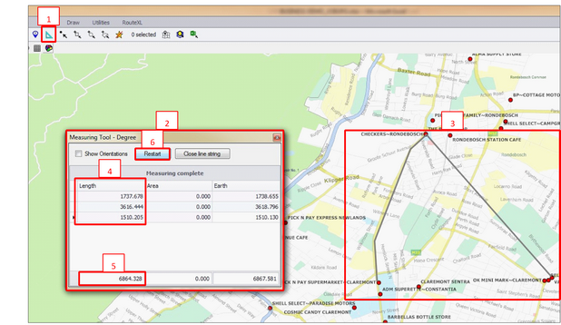
•Click the ‘Measure Tool’ ![]() in the Spatial Ribbon (1)
in the Spatial Ribbon (1)
•This will bring up the Measuring Tool Box (2)
•When you move your mouse to your map you should see a crosshair display
•Left click the points on the map you want to measure distances between. You can click two or more points (3)
•As you click the distance will display in the length column in meters (4)
•The total distance will display at the bottom (5)
•Double click to finish
•To clear distances and start again click ‘restart’ (6)
