The Inspector Tool ![]() allows you to click on a feature on your map, and view any associated (attribute) information for that feature
allows you to click on a feature on your map, and view any associated (attribute) information for that feature
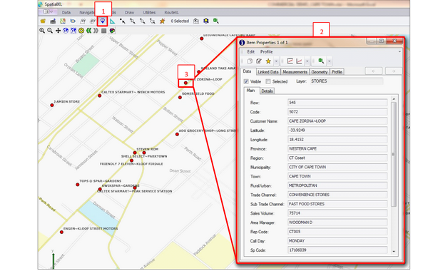
•Click the ‘Inspector Tool’ (1) ![]() in the Spatial Ribbon
in the Spatial Ribbon
•This will bring up an Item Properties box (2)
•Hover your mouse over your map, you should see a + i crosshair display
•Left click the required point on the map – the centre of the cross (+) is the point that will be displayed in the Item Properties (3)
•The item properties box will be populated with information from your spreadsheet

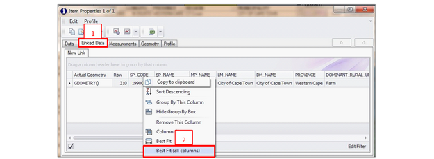
•Note, if you have any data that has been linked to your map layer e.g. from a excel spreadsheet, or a non-graphic layer, click the ‘Linked Data’ tab to view this data (1)
•If your column headings are cut short, right click any column and click ‘Best Fit (all columns)’ to expand them all (2)
