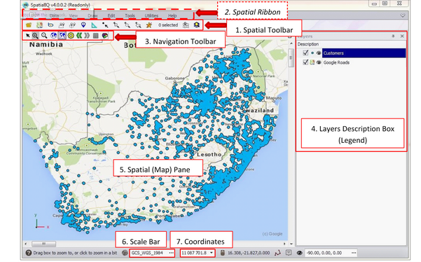
•Most of the Spatial Reader tools can be accessed from the ‘Spatial Toolbar’ (1).
•These are shortcuts to some of the most frequently used tools in the ‘Spatial Ribbon’ (2). Most of the tools in the Spatial Ribbon require a SpatialXL license and are not available for use in Spatial Reader.
•The ‘Navigation Toolbar’ (3) contains the tools that allow you to navigate around your maps e.g. zoom, pan, zoom fit etc.
•The ‘Layers Description’ box (4) is your layer control where you can switch layers on and off, choose themes and labels, access the layer grid etc.
•The ‘Spatial Pane’ (5) is your mapping interface
•The ‘Scale Bar’ (6) displays the scale as you zoom in and out of the map
•The ‘Coordinates’ (7) display the coordinates of the mouse position on the map
