❖ The grid provides a gridded background to assist 'mapping to scale'.
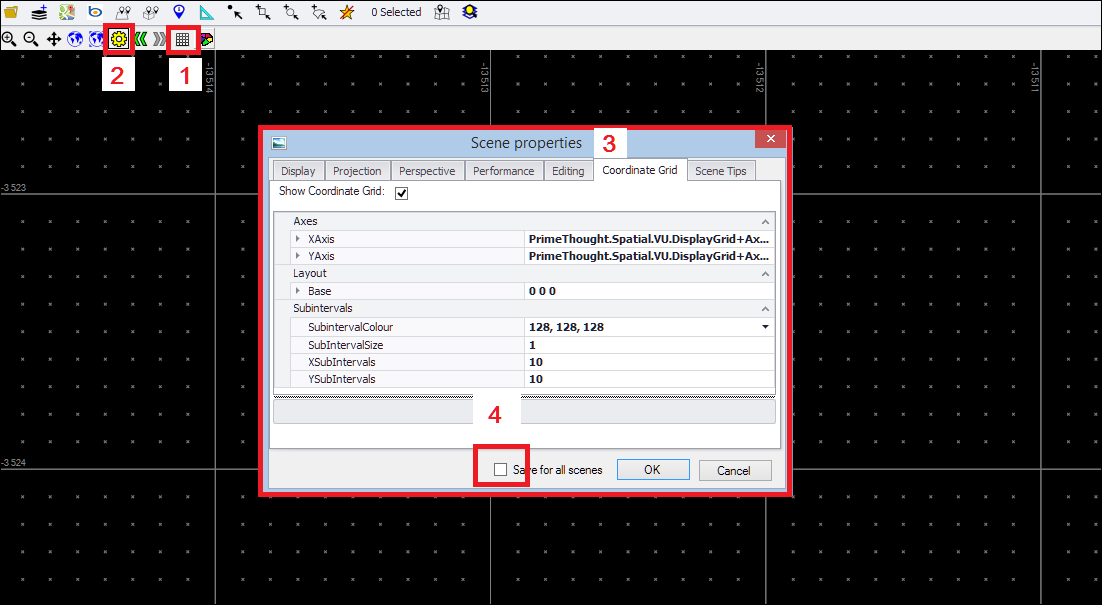
❖ To turn on the coordinate grid, you first click on the Grid button (1).
❖ If you click this button again, this will turn the grid off.
❖ To set the Grid size and interval, you can do this in the Scene Properties by clicking on the Scene Properties button (2) and then setting the Coordinate Grid values (3) in that tab.
❖ I set Subintervals of 10 on X and Y and then zoomed into my scene (by rolling my mouse wheel) until I could see the intervals clearly.
❖ Again, you can save this for all scenes (4)

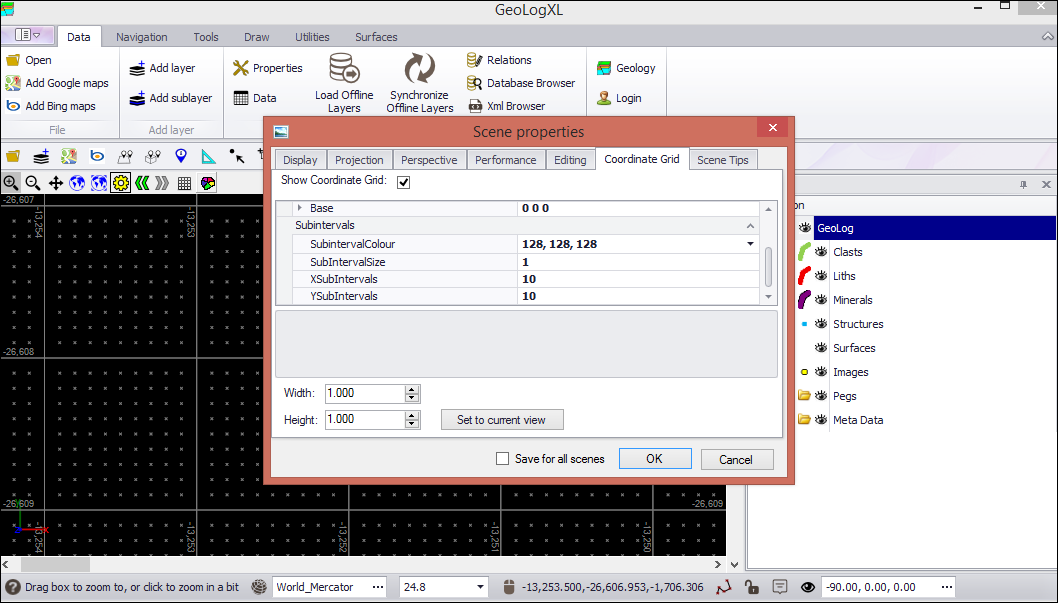
❖ You can also set the grid to follow the view (in the view plane) by clicking the Set to current view button. You can set the grid intervals by filling in the Width and Height fields when doing this:
