MineModeller fully supports projections.
MineModeller uses the Open Geo Spatial Consortium ( www.opengeospatial.org) Well Known Text Format (WKT) for specifying projections.
This allows full customization of the projection including the Spheroid and false Eastings and Northings.
Projections can be specified for Peg Groups, the Current design file and when importing data.
For Peg Groups the Projection specifies the coordinate system that the Pegs in that group are stored in.
For Design files the projection specifies the coordinate system used in the design file.
When Importing data one can specify the Projection of the data being imported so that it can be converted to the coordinate system of the design file.
This allows importing GPS readings in Lat/Long to the UTM metres coordinates stored in a design file.
By default a new design file has no Projection set.
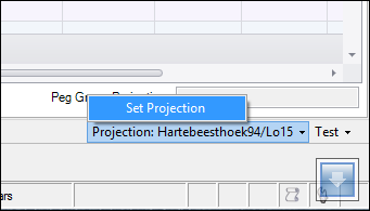
The projection for the current design file is shown on the bottom right toolbar in the MineModeller window:

Here the design file projection is set to Hartebeeshoek94/Lo15.
To set the design file projection click on the projection indicator and it brings up an option to set it:

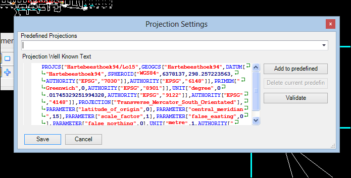
This brings up the projection choice dialog:

Choose the desired projection from the list in the top drop down. You can do a quick search by starting to type in the combo box.
Click save to set the new projection.
Note that MineModeller does not use the Geographic Coordinate System setting of MicroStation, but stores its own setting in the design file.